This post was originally published when the blog was still hosted on Blogger. When I moved to Github Pages, I imported these without much editing, thus the layout often seems odd, and some links may be broken. You can still visit the original version here.
Pixelmap: a neat "running scratchmap" tool
09 June 2017
For a while now, I pack my running gear, whenever and wherever I travel, and I try to explore the city/region by running. I think I can consider myself lucky, as I had the privilege of visiting quiet a few countries this way, and I always wanted to plot that on a world map. Today I decided to google around a little bit, and ended up with Pixelmap.

In my very first blogpost I've already scratched this idea, and used umap to create nice maps of tracks based on gpx data. That serves however a different purpose. I also tried to use Ahotu Marathons to record my races. This has the benefits of showing more races from the same country, however, I've found it pretty cumbersome to use. So today I ended up with Pixelmap, which is a really handy tool, if one prefers to do this kind of scratchmap for running.
A quick list of the most important features:
- Different projections
- Arbitrary zoom level
- Any number of colors
- Labels, Pins
- SVG, HTML and PNG export
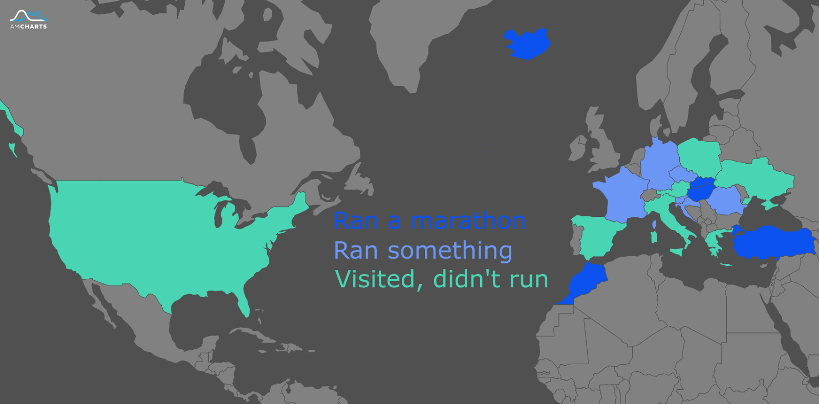
As a first try I defined 4 categories: not visited; visited, but no run; there was a run, but not a marathon; there wasat least one marathon. The endresult looks pretty nice:

The only thing I am missing is the ability to save it within the software for later extension.
So that's it, this was only a short post about this handy tool, and a way of breaking the silence here. Hopefully I'll come up soon with a travel blog entry.
And as always: Thanks for reading! Sharing, comments and +1s are always appreciated. You can follow the blog on Google+, Twitter, and Facebook. The embedded videos are collected in the RunnerMate playlist on youtube.